Chapter 1.1 (SST 5)

Natural Environments

Observe the pictures below.
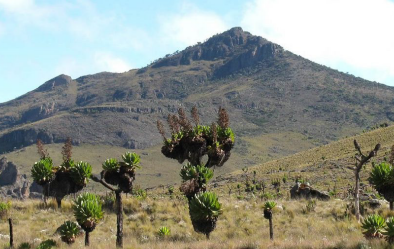
Picture (a)
Picture (b)
  1. What is picture (a) about?
  2. What is picture (b) about?
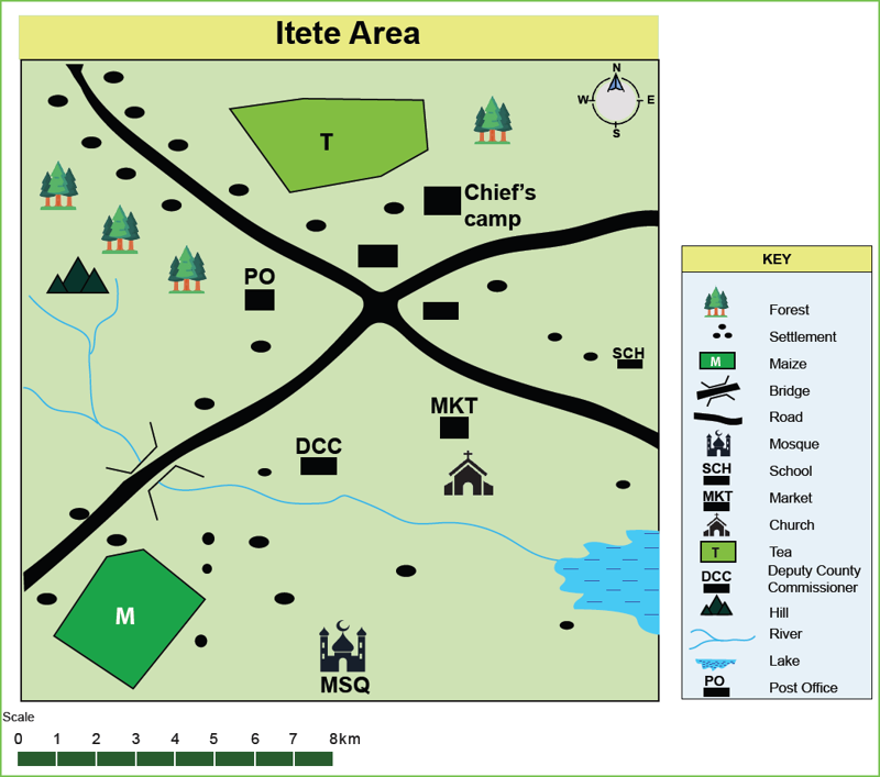
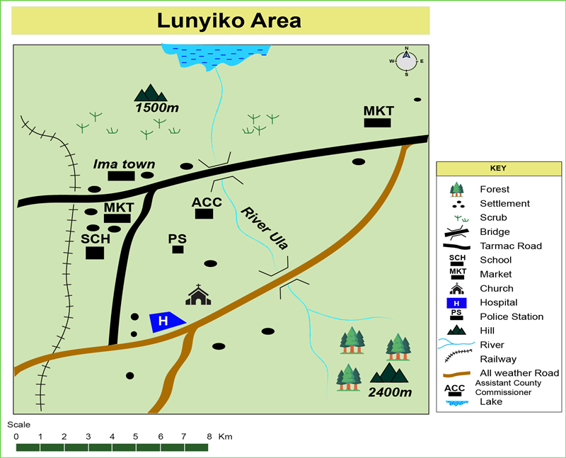
Elements of a Map

A map is a drawing which represents the earth or part of the earth on a flat surface. Elements of a map are the things written on a map which help us understand what is on the map.

Key Elements of a Map

Activity 1: Work on your own

Study the map of Sango Area below and use it to answer the questions.

Sango Area
  1. Identify the key elements of a map shown on the map of Sango Area.
  1. Complete the table below to show the uses of the elements of a map.

Element

Uses on a map

The name of the area being represented on the map.

Drawn to show the actual distance on the ground being represented on a map.

Helps us to find direction from one place to another.

The symbols, letters and colours which are used to represent real features on a map.

This is drawn around the map.

Key points

  • The main elements of a map are: title, frame, key (legend), scale and compass.
  • The map title is the name given to a map. It is usually written at the top of the map. The title helps us to know the name of the area covered by the map.
  • A frame is a border line drawn around a map. It makes a map to look neat.
  • A compass helps us to find direction on a map. It helps us to describe where one place is in relation to another. The four main compass points are North, South, East and West.
  • A scale shows the relationship between distances on the map and actual distances on the ground. For example, one centimetre of the road on the map could mean one kilometre long on the ground.

Activity 2: Work in pairs

Find out more
  1. Using sketch maps, atlas maps or wall maps, find out the scales used on these maps.
  2. Find out how we can use the scale to tell the distance from one place to another along a straight line.

The Map Key

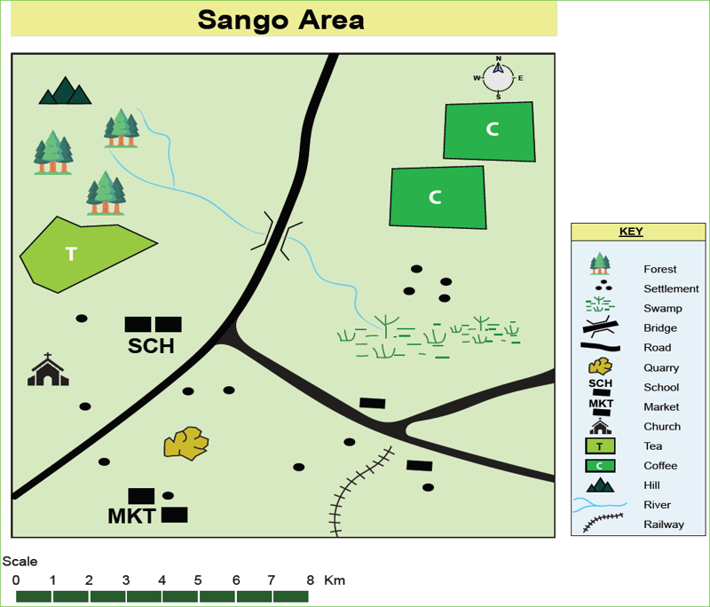
The key is an important element of a map. This is because it carries a lot of information about a map. The key uses symbols to help one understand things on a map. A symbol is a special little picture, line or shape that represents real objects found in the area covered by the map.

Key points

  • We use symbols to show things on a map.
  • Every map has a list of the symbols which are used on that map. Each symbol is also explained.
  • Different colours are also used to represent different things. For example, blue is used to show rivers and other water features. Green is used to show vegetation.

Activity 3: Group work

  1. 1. Complete the passage below by selecting the words provided in the brackets (map, key, use, opens, read, information, symbols, arranged, frame).

Thewe use on maps are accepted and used by all people of the world. This enables whoever is reading ato easily understand what is drawn on it. The symbols used on a map areoutside theof the map to make it easy for a person tothe map. This arrangement is known as theof the map. The keyto usabout maps which makes it easy tounderstand a map.

  • Bridge
  • Road
  • River
  • Lake
  • School
  • Market
  • Forest

Activity 4: Work on your own

Find out more

Using an atlas, internet or library, find out other symbols used on maps and their meaning.

Activity 5: Work on your own

  1. Draw a sketch map of your school and show the elements of a map.
  2. Share your map with your classmates.

Activity 6: Take home

Work with your parent or guardian
  1. Draw a sketch map of your home.
  2. Indicate the various elements of a map on the sketch map of your home.
  3. Share the sketch map of your home with your classmates.

Reading and Interpreting Maps Using the Key Elements

Activity 7: Work as a class

Gad:

What is map reading?

Ashton:

Map reading is the studying of a map to identify the things represented on it.

Gad:

What about map interpretation?

Ashton:

Map interpretation is the process of giving meaning to the features shown on a map.

Gad:

How do we read and interpret maps?

Ashton:

We read and interpret maps using the key elements. Do you remember them?

​Gad:

I remember the title, key, compass and scale.

Ashton:

We interpret maps by studying the key and scale carefully. We use the symbols in the key to understand the things shown on a map.

Gad:

Why do we use symbols on a map?

Ashton:

This is because we cannot draw mountains, towns, animals and people on a map. We use symbols to represent them on a map. The symbols are then put in the key.

​Gad:

We can also use the key to find out the human activities carried out in the area covered by a map. These include farming, fishing, quarrying, transport, education and administration, among others.​

  1. What is map reading?
    Map reading is studying a map to identify
  2. What is map interpretation?
  • Map interpretation is the process of giving meaning to the features shown on the map.
  • Map interpretation is the process of giving meaning to politics.
  • Map interpretation is the process of giving meaning to wildlife.
  1. What do we use to read and interpret maps?
  2. Why is the key important in map reading and interpretation?
  • It looks nice.
  • It opens up information about the features found on the map through the symbols.
  1. Which are some of the features that can be interpreted on a map?
  • Physical features
  • Trees
  • Settlement
  • Drainage
  • Buildings
  • Vegetation

Activity 8: Work on your own

  1. What is the title of the map
  2. Give the direction of the school from the market
  3. Give the direction of the hill from the chief’s camp
  4. Mark the distance of the school from the church.
  • ∼ 4 km
  • ∼ 5 km
  • ∼ 6 km
  • ∼ 7 km
  1. Mark two crops grown in the area covered by the map.
  • Forest
  • Maize
  • Church
  • River
  • Tea
  • Lake
  1. Mark the physical features found in the area covered by the map.
  • Forest
  • Hill
  • Church
  • River
  • Tea
  • Lake
  1. Mark three settlement patterns found in the area covered by the map.
  • Sparse
  • Linear
  • Scattered
  • Dispersed
  • Nucleated

Activity 9: Work on your own

  1. Using Google, search for elements of a map.
  2. Write down your findings and present in class.
  3. Watch the following video clip on symbols of maps.
Maps - Signs and Symbols

Uses of Maps

Maps are important to us in our daily lives. How do we use maps? Let us find out together.

Remember

Maps are important in our daily life. They help us to find direction to different places. They also help us to get information about different places. Maps help us to become aware of our environment so that we can take care of it.

Activity 10: Group work

  1. Discuss the uses of maps.
  2. Make a summary for class presentation.

New words garden

  1. Using a dictionary, find out the meaning of the following new words.
    1. environment –  
    2. economic – 
    3. social –  
    4. natural –  
    5. elements –  
    6. interpretation –  
  2. Make a sentence using each of the new words.

Activity 11: Work in pairs

  1. I am a. I use maps to land the aeroplane at the
  2. I am a. I use a map to navigate and dock theat the.
  3. I am a. I use a map to take my truck from one the other.
  4. I am a . I use a map to get to the tourist .
  5. I am a . I use maps to learn more about .
  6. I am a. I use maps to show the boundary of my

Activity 12: Group work

Using a computer, a tablet or a smart phone, use Google maps to find out the following:

  1. The schools neighbouring your school.
  2. The towns near your school.

Activity 13: Work as a class

My community
  1. Draw a map of your home area and show the key elements of a map.
  2. Place the map at a public place to help visitors find direction.

Assessment Exercise 1

  1. A drawing which represents the earth or part of the earth on a flat surface is called a .
  1. Which one of the following is not a key element of a map?
  • Title
  • Forest
  • Key
  • Compass
  • Frame
  • Scale
  1. Select the correct uses of the key elements of a map.

Element

Use

It shows the relationship between the actual distance on the ground and distance on the map.

Marks out the area covered by the map. It also makes the map to be neat and complete.

It identifies and interprets symbols used on a map.

It shows the position of a place in relation to other places.

The name given to a map.

  1. Draw a sketch map of your class and show the elements of a map.
    Use the map of Lunyiko Area to answer questions 5 to 10.
Lunyiko Area
  1. The general direction of flow of River Ula is from  to .
  2. What is the approximate length in kilometres of the railway line shown on the map?
  • 15
  • 13
  • 17
  1. Mark the social services available in Lunyiko Area.
  • Health
  • Education
  • Religion
  • Administration
  • Swimming
  1. Mark the types of vegetation found in the area covered by the map
  • Scrub
  • Tea
  • Forest
  1. Which one of the following is not a drainage feature in the area covered by the map?
  • River
  • Bridge
  • Lake
  1. Mark the relief feature in the area covered by the map.
  • Church
  • Hills
  • Railway
Please wait